
Interactive Map of Fire Zone Map Comparisons
The City of San Diego has published an interactive map of the proposed 2025 Very High Fire Hazard Severity Zones to amend the base map published by the California Office of the State Fire Marshal.
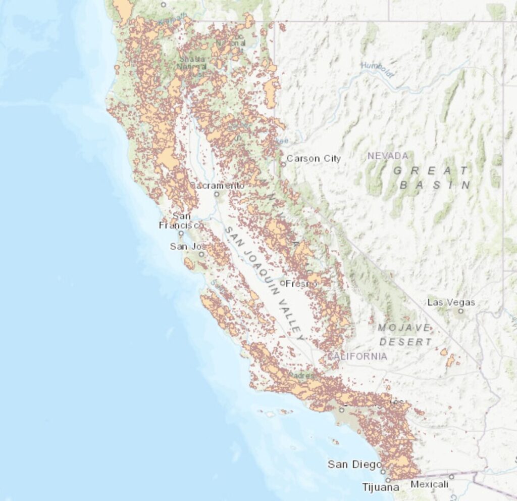
California Fire Perimeters (1898-2020)
Interactive map showing fire ocations and sizes over time in California. Created by Conservation Biology Institute and hosted by Data Basin.
Frontline Wildfire Tracking Map
San Diego wildfire map and resources presented by Frontline.
Interactive Map of Bonus ADU Builds in Very High Fire Hazard Severity Zones
This map is based on data from the housing commission and maps all 272 Bonus ADU program projects in the city of San Diego. Sites inside the (pre 3/24/25) VHFHSZ are marked in red

State Fire Marshal Interactive Map of Very High Fire Hazard Severity Zones
This map replaces the maps developed by the City of San Diego showing Very High Fire Hazard Zones and was adopted on 3/24/25. See this article for more details.
San Diego Interactive Map of Very High Fire Hazard Severity Zones
The city of San Diego maintains an interactive map showing Very High Fire Hazard Zones as required and defined by the state fire marshal. This map was replaced on 3/24/25 with a state defined map. See this article for more details.
San Diego Interactive Map of Fire Hydrant Locations
The city of San Diego maintains an interactive map showing fire hydrant locations along with data related to size and number of ports.
San Diego Interactive Map of Water Mains
The city of San Diego maintains an interactive map showing locations and sizes of water mains.

San Francisco Emergency Firefighting Water System Map
The City and County of San Francisco’s Emergency Firefighting Water System has a unique Auxiliary Water Supply System (AWSS). The system consists of a resilient 135-mile pipeline network, a high elevation reservoir, two large capacity tanks, two seawater pumping stations, and intakes to use seawater from the bay.

FEMA National Risk Index Map
FEMA Maintains a risk map that may be set to census tract level and then filtered for wildfire risk.

SANDAG Interactive Map of 2007 Firestorm Damages
SANDAG recorded damages sustained in the 2007 Firestorm. Note homes identified and proximity to canyons.
Cal Fire Structure Status Map – Palisades Fire
Cal Fire is doing house by house structure damage assessments on an interactive map with linked data and photos.

Cal Fire Structure Status Map – Eaton Fire
Cal Fire is doing house by house structure damage assessments on an interactive map with linked data and photos.
