
-

Additional articles regarding fire safety area available on the Kensington Firesafe Council website. A great resource for tracking changes in the Very High Fire Hazard Zones and new Zone Zero policy.
-
An independent after-action review of alerts and evacuations has been completed by McChrystal Group, providing a comprehensive picture of actions taken during the catastrophic January wildfires along with recommendations to help guide future Los Angeles County responses. A full copy of the report is here. Highlights of findings and recommendations are here. The review—the first in a…
-

The amendments to the City’s Accessory Dwelling Unit (ADU) and Junior Accessory Dwelling Unit (JADU) have been adopted as of August 22, 2025. The amendments address several aspects of ADU and JADU development, including minimum and maximum unit sizes, conversions, rental terms, the number of ADU homes permitted, tree requirements, setback requirements within High and…
-

The San Diego Bonus ADU program has many flaws but of chief concern for urban wildfire safety are those aspects that allow dense construction in the urban wildland interface without consideration for safe evacuation. The regulation modifications related to urban wildfire safety are listed and annotated below. City Council will be doing a second reading…
-

SB79 will eliminate residential zoning by creating a statewide overlay that will allow five to seven story buildings on any land within a radius of transportation even if the transportation services are planned decades in the future without funding. Why this is an urban wildfire risk has to do with housing density in areas that…
-

The City of San Diego has published an interactive map of the proposed 2025 Very High Fire Hazard Severity Zones to amend the base map published by the California Office of the State Fire Marshal. The changes are very good! Hopefully, the city will apply good policy regarding density, infrastructure, and fire safety/rescue using this…
-

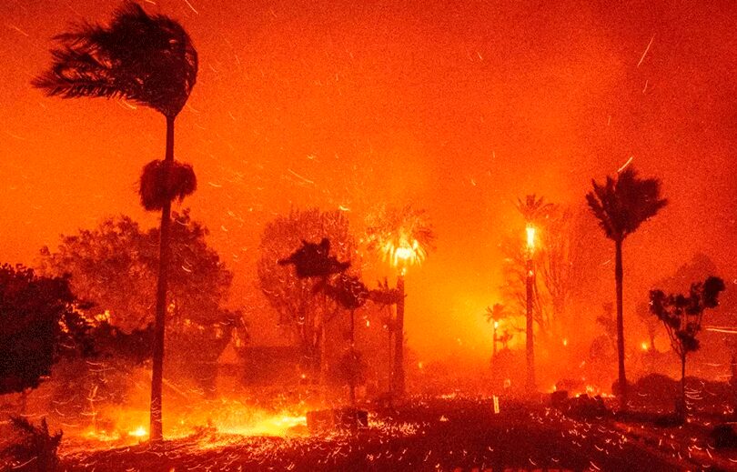
As Los Angeles reels from the devastating loss of 16,251 structures and 29 lives in the Palisades and Eaton fires, city, county, and state are studying the ashen landscape to learn how we can better survive the next urban wildfire. Those lessons will be essential in crafting new policies for land use, building codes, infrastructure…
-
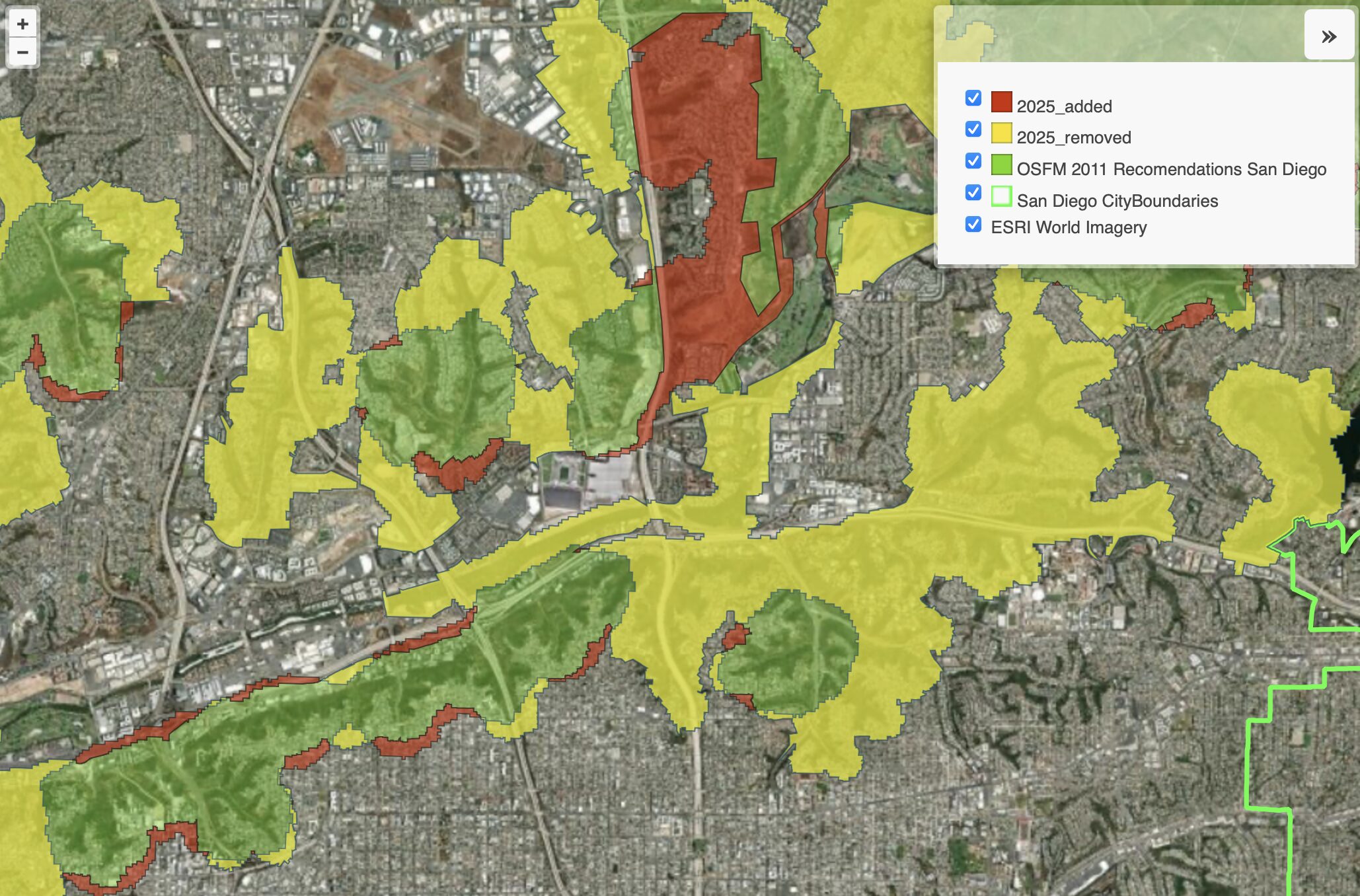
A Visual Guide to the Changes Despite the Fire Hazard Zone Maps released March 26th 2025 by the Office of the State Fire Marshall (OSFM) increasing the amount of acreage included state wide, there are significant reductions within the urban areas of San Diego. This is primary due to the new method considering climate, slope,…
-

Lack of Brush Management is the Fuse to the San Diego Powder Keg The Office of the City Auditor made seven recommendations to San Diego leadership in July of 2023 regarding brush management on City owned land. All of the recommendations were accepted, however, the COO that signed off on the advice had their position…
-
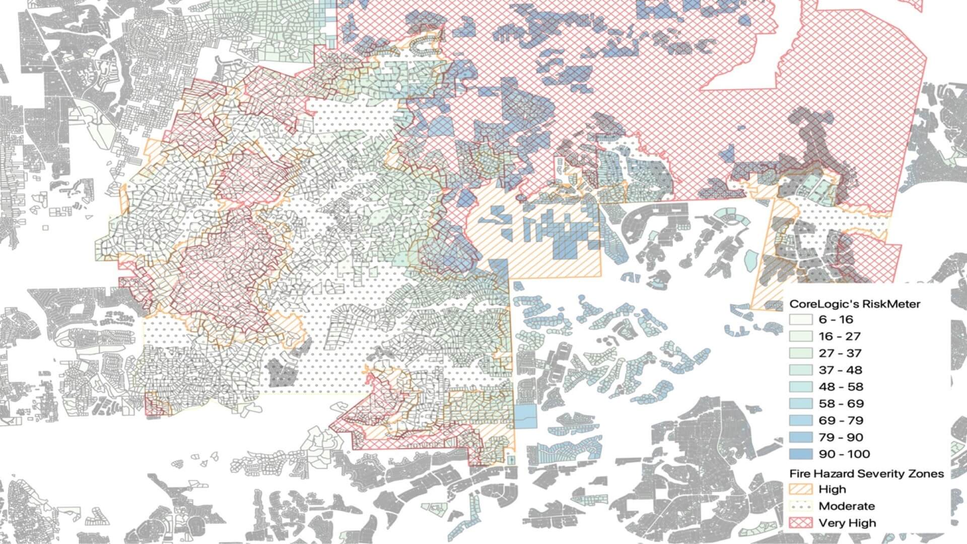
CoreLogic Property Data Science Team Takes a Hard Look CoreLogic provides property industry professionals with access to big data and cutting-edge analytics solutions, including location intelligence. In this study, CoreLogic examines the impact of wildfire risks on property values in San Diego County, since it is one of the California counties most vulnerable to these disasters. The property data…