
A Visual Guide to the Changes
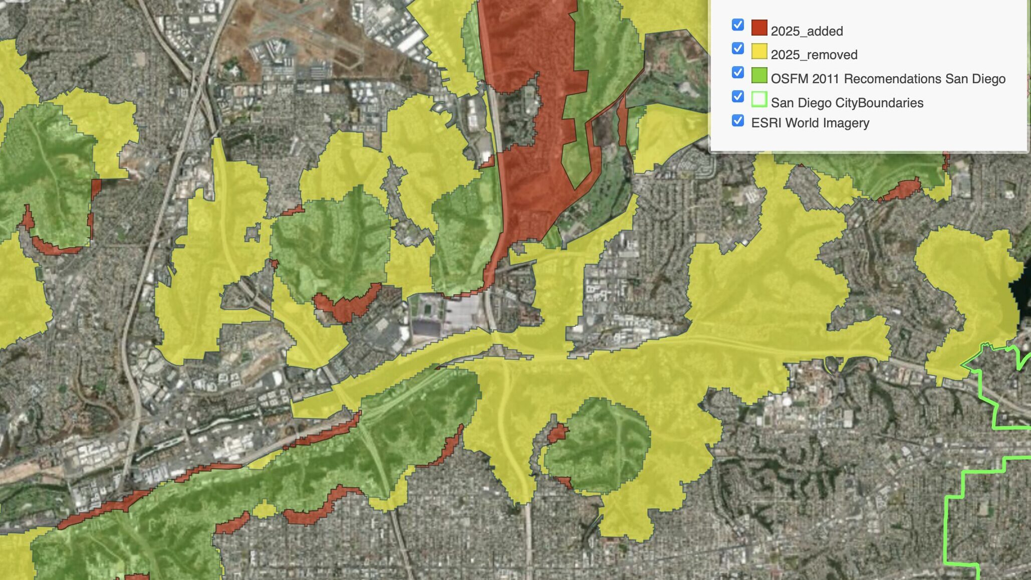
Despite the Fire Hazard Zone Maps released March 26th 2025 by the Office of the State Fire Marshall (OSFM) increasing the amount of acreage included state wide, there are significant reductions within the urban areas of San Diego. This is primary due to the new method considering climate, slope, vegetation, and fire history that has minimal information on urban areas. Additionally, urban areas are averaged based on 20 acre tiles that overlook the narrow canyons lacing through the city.
San Diego has 120 days to respond with updates that expand on the OSFM map (Deadline July24th). Any modifications made beyond that date would be done via code update and would be the responsibility of the city to maintain those addendums. We have word that the city intends on using their canyon maps to expand the fire hazard zones either within the 120 day process or after the fact.
The map below illustrates the overlaps between the old and new maps. You can also explore the map in a new window.
In this animation we can see how the location of the 10/31/25 Montezuma Fire fall both inside and outside the VHFHSZ despite the entire area being a continuous terrain.

There is no formal comment period required by state law, however, the City of San Diego is taking public comment and fielding questions on this Comment Form.