Category: Policy
-
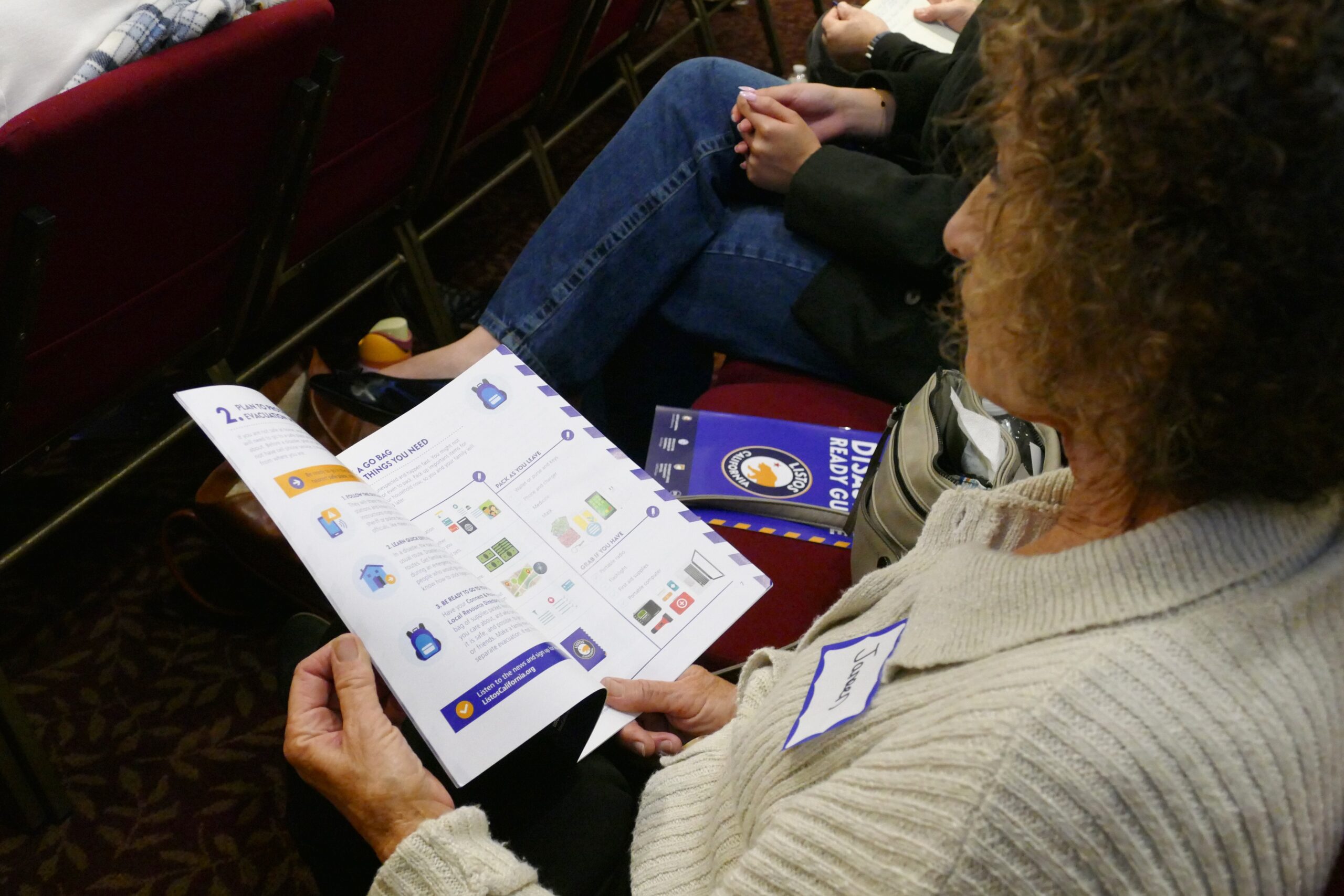
Additional articles regarding fire safety area available on the Kensington Firesafe Council website. A great resource for tracking changes in the Very High Fire Hazard Zones and new Zone Zero policy.
-
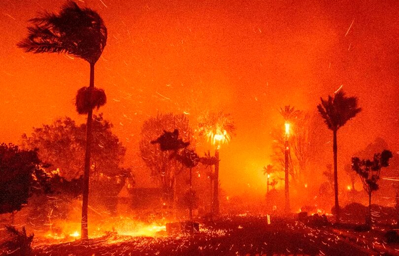
An independent after-action review of alerts and evacuations has been completed by McChrystal Group, providing a comprehensive picture of actions taken during the catastrophic January wildfires along with recommendations to help guide future Los Angeles County responses. A full copy of the report is here. Highlights of findings and recommendations are here. The review—the first in a…
-

The City of San Diego has published an interactive map of the proposed 2025 Very High Fire Hazard Severity Zones to amend the base map published by the California Office of the State Fire Marshal. The changes are very good! Hopefully, the city will apply good policy regarding density, infrastructure, and fire safety/rescue using this…
-
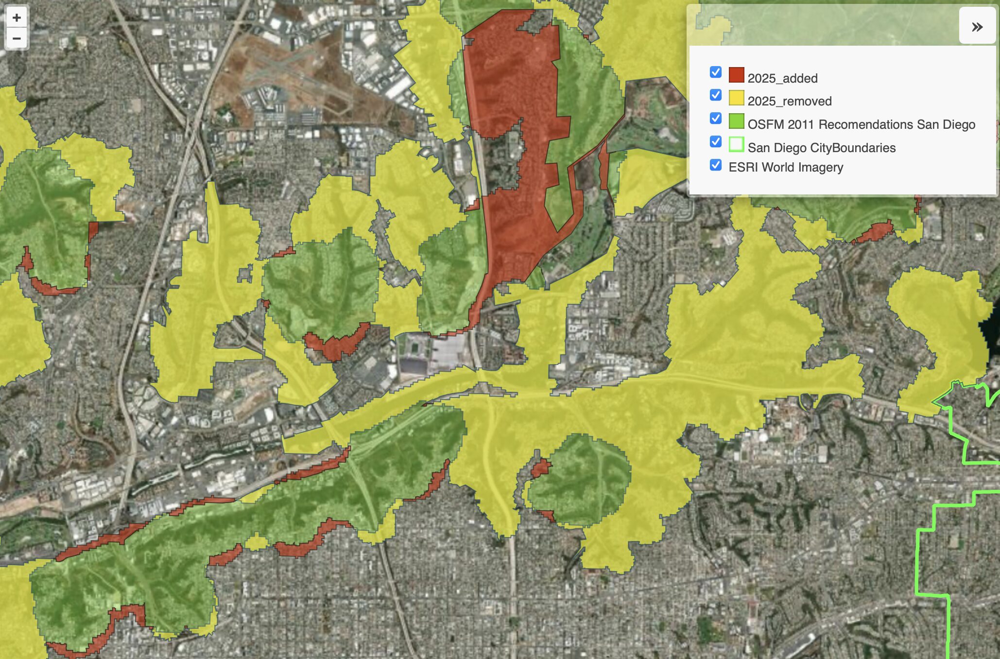
A Visual Guide to the Changes Despite the Fire Hazard Zone Maps released March 26th 2025 by the Office of the State Fire Marshall (OSFM) increasing the amount of acreage included state wide, there are significant reductions within the urban areas of San Diego. This is primary due to the new method considering climate, slope,…
-

Lack of Brush Management is the Fuse to the San Diego Powder Keg The Office of the City Auditor made seven recommendations to San Diego leadership in July of 2023 regarding brush management on City owned land. All of the recommendations were accepted, however, the COO that signed off on the advice had their position…
-
As wildfires become more frequent and intense, urban planning plays a critical role in reducing risk and ensuring community resilience. Thoughtful development strategies can help mitigate wildfire impacts while fostering safer, more sustainable cities. Strategic Land Use Planning Urban planning should prioritize development in low-risk areas while limiting expansion into Very High Fire Hazard Severity…